File:GalacticCivilWarYear14.jpg

Size of this preview: 606 × 600 pixels. Other resolutions: 242 × 240 pixels | 980 × 970 pixels.
Original file (980 × 970 pixels, file size: 575 KB, MIME type: image/jpeg)
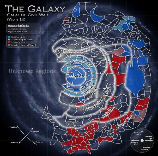
A map of the Galactic Civil War with the territories of the Imperial Union and the Galactic Alliance, following the Unions's admission of the Anzatan Commonwealth on Year 14 Day 184.
File history
Click on a date/time to view the file as it appeared at that time.
| Date/Time | Thumbnail | Dimensions | User | Comment | |
|---|---|---|---|---|---|
| current | 15:44, 19 July 2013 | | 980 × 970 (575 KB) | Alex Tylger (talk | contribs) | A map of the Galactic Civil War with the territories of the Imperial Union and the Galactic Alliance, following the Unions's admission of the Anzatan Commonwealth on Year 14, Day 184. |
- You cannot overwrite this file.